ढाँचा:Infobox earthquake/कागजात
Usage
सम्पादन गर्नुहोस्{{Infobox earthquake
|title =
|image =
|image alt =
|imagecaption =
|map =
|map alt =
|image name =
|map2 =
|mapsize =
|caption =
|date = <!-- {{Start-date|any date with or without time, any format}} -->
|origintime =
|duration =
|magnitude = <!-- NNN [[Moment magnitude scale|M<sub>w</sub>]] -->
|depth = <!-- {{convert|NNN|km|mi|0|abbr=on}} -->
|location = <!-- {{coord|XXXXX|region:XX_type:event|display=inline,title}} -->
|type =
|countries affected =
|damage =
|intensity =
|PGA = <!-- NN''[[Peak ground acceleration|g]]'' -->
|tsunami =
|landslide =
|aftershocks =
|casualties =
}}
Examples
सम्पादन गर्नुहोस् Effects of the earthquake on the Pan-American Highway between Ica and Lima | |
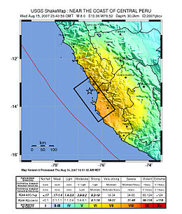
 Map of the Peru coastline, showing location and strength of quake. Star marks epicenter. | |
| युटिसी समय | ?? |
|---|---|
| अवधि | 3 minutes |
| म्याग्निच्युड | 8.0 Mw |
| गहिराइ | ३९ किमी (२४ माइल) |
| अधिकेन्द्र | १३°२१′१४″S ७६°३०′३२″W / १३.३५४°S ७६.५०९°Wनिर्देशाङ्कहरू: १३°२१′१४″S ७६°३०′३२″W / १३.३५४°S ७६.५०९°W |
| प्रभावित क्षेत्र | Peru |
| सुनामी | flooded part of Lima's Costa Verde highway, and much of Pisco's shore |
| मानवीय क्षति | 519 confirmed dead 1,366 injured |
{{Infobox earthquake
|title              = 2007 Peru earthquake
|image              = 38 - Tremblement de terre - Août 2007.JPG
|image alt          = Effects of the earthquake on the Pan-American Highway between Ica and Lima
|imagecaption       = Effects of the earthquake on the Pan-American Highway between Ica and Lima
|map                = Peru Quake Aug 15-2007.jpg
|map alt            = The quake's center was near the coast of central Peru; the closest settlements were Imperial and Chincha Alta. The damage zone went about 100 km inland and north, and about 200 km south.
|image name         = <small>Map of the Peru coastline, showing location and strength of quake. Star marks [[epicenter]].</small>
|date               = {{Start-date|15 August 2007}}
|origintime         = 23:40:57 [[UTC]]<br/> 18:40:57 [[Time in Peru|PET]]
|duration           = 3 minutes
|magnitude          = 8.0 [[Moment magnitude scale|M<sub>w</sub>]]
|depth              = {{convert|39|km|mi|0|abbr=on}}
|location           = {{coord|13.354|S|76.509|W|region:PE_type:event|display=inline,title}}
|countries affected = [[Peru]]
|tsunami            = flooded part of Lima's Costa Verde highway, and much of Pisco's shore
|casualties         = 519 confirmed dead<br /> 1,366 injured
}}
Microformat
सम्पादन गर्नुहोस्The HTML mark up produced by this template includes an hCalendar microformat, which makes the event details parsable by computers, either acting automatically to catalogue articles across Wikipedia, or via a browser tool operated by a person, to (for example) add the subject to a calendar or diary application. For more information about the use of microformats on Wikipedia, please see the microformat project.
Dates will only be included if you use {{Start date}} or {{End date}} (use the former for single dates; but do not use any of these if the date is before 1583 CE).
URLs will only be included if you use {{URL}}.
hCalendar uses HTML classes including:
- attendee
- contact
- description
- dtend
- dtstart
- location
- organiser
- summary
- url
- vevent
Please do not rename or remove these classes; nor collapse nested elements which use them.