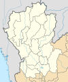
चित्र:Thailand Northern (17 provinces) location map.svg

Size of this PNG preview of this SVG file: ५०० × ६०० पिक्सल. अरु संकल्पहरू: २०० × २४० पिक्सल • ४०० × ४८० पिक्सल • ६४० × ७६८ पिक्सल • ८५३ × १,०२४ पिक्सल • १,७०७ × २,०४८ पिक्सल • ६०० × ७२० पिक्सल।
मूल फाइल (SVG फाइल,साधारण ६०० × ७२० पिक्सेलहरु, फाइल आकार: १७८ किलोबाइटहरू)
फाइल इतिहास
मिति/समय मा क्लिक गरेर त्यससमयमा यो फाइल कस्तो थियो भनेर हेर्न सकिन्छ ।
| मिति/समय | छोटो चित्र | आकारहरू | प्रयोगकर्ता | टिप्पणी | |
|---|---|---|---|---|---|
| हालको | ०३:११, १४ सेप्टेम्बर २०१९ |  | ६००×७२० (१७८ किलोबाइटहरू) | ZeroSixTwo | User created page with UploadWizard |
फाइल प्रयोग
यो फाइलसँग कुनै पनि पृष्ठ जोडिएको छैन।
विश्वव्यापी फाइल प्रयोग
निम्न अन्य विकिहरूमा यस फाइलको प्रयोग:
- id.wikipedia.org मा उपयोग
- th.wikipedia.org मा उपयोग
- ไทยลีก 4 ฤดูกาล 2561 – โซนภาคเหนือ
- ไทยแลนด์ อเมเจอร์ลีก ฤดูกาล 2561 – โซนภาคเหนือ
- ไทยลีก 4 ฤดูกาล 2562 – โซนภาคเหนือ
- ไทยแลนด์ อเมเจอร์ลีก ฤดูกาล 2562 – โซนภาคเหนือ
- มอดูล:Location map/data/Thailand Northern (17 provinces)
- ไทยลีก 4 ฤดูกาล 2563 – โซนภาคเหนือ
- ไทยลีก 3 ฤดูกาล 2564–65 – โซนภาคเหนือ
- ไทยแลนด์ อเมเจอร์ลีก ฤดูกาล 2565 – โซนภาคเหนือ
- ไทยลีก 3 ฤดูกาล 2565–66 – โซนภาคเหนือ
- ไทยแลนด์ เซมิโปรลีก ฤดูกาล 2566 – โซนภาคเหนือ
- ไทยแลนด์ อเมเจอร์ลีก ฤดูกาล 2566 – โซนภาคเหนือ
- ไทยลีก 3 ฤดูกาล 2566–67 – โซนภาคเหนือ
- ไทยแลนด์ เซมิโปรลีก ฤดูกาล 2567 – โซนภาคเหนือ
- มอดูล:Location map/data/Thailand Northern (17 provinces)/doc