चित्र:LocationWesternAfrica.png
उच्च रिजोल्युशन अनुपलब्ध
LocationWesternAfrica.png (३५९ × ३५९ पिक्सेलहरू, फाइल आकार: ७ किलोबाइटहरू, MIME प्रकार: image/png)
| यो विकिमीडिया कमन्सको चित्र हो। त्यहाँ यसको विवरण पृष्ठबाट जानकारी तल देखाइएको छ। कमन्स स्वतन्त्र रूपमा इजाजतपत्र प्राप्त चित्र भण्डार हो। तपाईंले मद्दत गर्न सक्नुहुन्छ। |

|
File:Africa-countries-western.svg is a vector version of this file. It should be used in place of this PNG file when not inferior.
File:LocationWesternAfrica.png → File:Africa-countries-western.svg
For more information, see Help:SVG. |
 |
सारांश
| वर्णन |
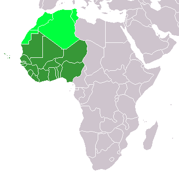
Map: Africa – Western Africa:
|
| मिति | ४ फेब्रुअरी २००६ (original upload date) |
| स्रोत | No machine-readable source provided. Own work assumed (based on copyright claims). |
| लेखक | No machine-readable author provided. E Pluribus Anthony~commonswiki assumed (based on copyright claims). |
अनुज्ञा प्राप्त गर्दै
| I, the copyright holder of this work, release this work into the public domain. This applies worldwide. In some countries this may not be legally possible; if so: I grant anyone the right to use this work for any purpose, without any conditions, unless such conditions are required by law. |
फाइल इतिहास
मिति/समय मा क्लिक गरेर त्यससमयमा यो फाइल कस्तो थियो भनेर हेर्न सकिन्छ ।
| मिति/समय | छोटो चित्र | आकारहरू | प्रयोगकर्ता | टिप्पणी | |
|---|---|---|---|---|---|
| हालको | १९:०२, ११ नोभेम्बर २०२२ | | ३५९×३५९ (७ किलोबाइटहरू) | ColorfulSmoke | . |
| १७:४१, ११ नोभेम्बर २०२२ |  | ३६०×३५९ (७ किलोबाइटहरू) | ColorfulSmoke | ||
| २२:३२, १७ मार्च २०१८ |  | ३६०×३९२ (१० किलोबाइटहरू) | Maphobbyist | Upload | |
| ०२:३९, १ अप्रिल २०१६ |  | ३६०×३९२ (१३ किलोबाइटहरू) | Fry1989 | Reverted to version as of 21:24, 9 July 2011 (UTC) | |
| ०५:०९, १६ मार्च २०१६ |  | ३६०×३९२ (१० किलोबाइटहरू) | Hpyounes | new colors | |
| ०३:०९, १० जुलाई २०११ |  | ३६०×३९२ (१३ किलोबाइटहरू) | Maphobbyist | South Sudan has become independent on July 9, 2011. Sudan and South Sudan are shown with the new international border between them. | |
| १३:५४, ११ डिसेम्बर २००७ |  | ३६०×३९२ (१४ किलोबाइटहरू) | Hoshie | added Cabinda (Angola) and Montenegro. | |
| १६:४०, ५ फेब्रुअरी २००६ |  | ३६०×३९२ (८ किलोबाइटहरू) | E Pluribus Anthony~commonswiki | Map: Western Africa, including Maghreb (location) | |
| ०१:३७, ५ फेब्रुअरी २००६ |  | ३६०×३९२ (९ किलोबाइटहरू) | E Pluribus Anthony~commonswiki | Map: Western Africa, including Maghreb (location) |
फाइल प्रयोग
यस फाइलमा निम्न 5 पृष्ठहरू जोडिन्छन्:
विश्वव्यापी फाइल प्रयोग
निम्न अन्य विकिहरूमा यस फाइलको प्रयोग:
- ab.wikipedia.org मा उपयोग
- ace.wikipedia.org मा उपयोग
- af.wikipedia.org मा उपयोग
- als.wikipedia.org मा उपयोग
- am.wikipedia.org मा उपयोग
- ar.wikipedia.org मा उपयोग
- ليبيا
- جيبوتي
- موريتانيا
- تونس
- السودان
- الصحراء الغربية
- أنغولا
- أوغندا
- إسبانيا
- تشاد
- النيجر
- مالي
- السنغال
- غامبيا
- غينيا بيساو
- غينيا
- سيراليون
- ليبيريا
- غانا
- توغو
- بنين
- بوركينا فاسو
- الصومال
- كينيا
- تنزانيا
- الغابون
- زامبيا
- موزمبيق
- زيمبابوي
- البرتغال
- الكاميرون
- جمهورية الكونغو الديمقراطية
- بوتسوانا
- جنوب إفريقيا
- جمهورية إفريقيا الوسطى
- جمهورية الكونغو
- سيشل
- ناميبيا
यस फाइलको विश्वव्यापी उपयोगको अधिक जानकारी हेर्नुहोस् ।