चित्र:Cooks Karte von Neufundland.jpg

यस पूर्व रुपको आकार: ६१५ × ५९९ पिक्सल। अरु संकल्पहरू: २४६ × २४० पिक्सल • ४९२ × ४८० पिक्सल • ७८८ × ७६८ पिक्सल • १,०५१ × १,०२४ पिक्सल • १,५०० × १,४६२ पिक्सल।
मूल फाइल (१,५०० × १,४६२ पिक्सेलहरू, फाइल आकार: ५२१ किलोबाइटहरू, MIME प्रकार: image/jpeg)
| यो विकिमीडिया कमन्सको चित्र हो। त्यहाँ यसको विवरण पृष्ठबाट जानकारी तल देखाइएको छ। कमन्स स्वतन्त्र रूपमा इजाजतपत्र प्राप्त चित्र भण्डार हो। तपाईंले मद्दत गर्न सक्नुहुन्छ। |
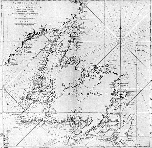
| वर्णन | A general chart of the island of Newfoundland. Surveyed by James Cook and Michael Lane, and "publish'd according to Act of Parliament by Thomas Jefferys Geographer to the King, 1775." |
| मिति | |
| स्रोत | originally uploaded to en.wikipedia by Jcmurphy on 23 Apr 2005; copied from "Courtesy of the Centre for Newfoundland Studies, Memorial University of Newfoundland, St. John's, Newfoundland." |
| लेखक | Michael Lane and James Cook |
| अनुमति (यो फाइल पुनप्रयोग गर्न) |
Public domain because of age |
|
This work is in the public domain in its country of origin and other countries and areas where the copyright term is the author's life plus 100 years or fewer. | |
| This file has been identified as being free of known restrictions under copyright law, including all related and neighboring rights. | |
फाइल इतिहास
मिति/समय मा क्लिक गरेर त्यससमयमा यो फाइल कस्तो थियो भनेर हेर्न सकिन्छ ।
| मिति/समय | छोटो चित्र | आकारहरू | प्रयोगकर्ता | टिप्पणी | |
|---|---|---|---|---|---|
| हालको | ००:५५, ७ जनवरी २००६ | | १,५००×१,४६२ (५२१ किलोबाइटहरू) | Schaengel89~commonswiki | {{Information| |Description =A general chart of the island of Newfoundland. Surveyed by James Cook and Michael Lane, and "publish'd according to Act of Parliament by Thomas Jefferys Geographer to the King, 1775." |Source =originally yuploaded to |
फाइल प्रयोग
यस फाइलमा निम्न पृष्ठ जोडिन्छ:
विश्वव्यापी फाइल प्रयोग
निम्न अन्य विकिहरूमा यस फाइलको प्रयोग:
- bs.wikipedia.org मा उपयोग
- ca.wikipedia.org मा उपयोग
- de.wikipedia.org मा उपयोग
- en.wikipedia.org मा उपयोग
- en.wikivoyage.org मा उपयोग
- eo.wikipedia.org मा उपयोग
- es.wikipedia.org मा उपयोग
- fi.wikipedia.org मा उपयोग
- fr.wikipedia.org मा उपयोग
- fur.wikipedia.org मा उपयोग
- ga.wikipedia.org मा उपयोग
- gl.wikipedia.org मा उपयोग
- he.wikipedia.org मा उपयोग
- hy.wikipedia.org मा उपयोग
- ia.wikipedia.org मा उपयोग
- it.wikipedia.org मा उपयोग
- ja.wikipedia.org मा उपयोग
- ka.wikipedia.org मा उपयोग
- ko.wikipedia.org मा उपयोग
- la.wikipedia.org मा उपयोग
- li.wikipedia.org मा उपयोग
- lt.wikipedia.org मा उपयोग
- mk.wikipedia.org मा उपयोग
- no.wikipedia.org मा उपयोग
- oc.wikipedia.org मा उपयोग
- pl.wikipedia.org मा उपयोग
- pl.wiktionary.org मा उपयोग
- pt.wikipedia.org मा उपयोग
यस फाइलको विश्वव्यापी उपयोगको अधिक जानकारी हेर्नुहोस् ।